|
|
 |
Gangolihat
the village derives its name from Gangoli, the name of the pargana and
Hat, a name by which the place is locally called. It is a small Himalayan
hill town in the Pithoragarh district of Uttarakhand, India. It is tehsil
and sub divisional headquarter of the district. Gangolihat is famous for
its Shakti Peethas of Hat Kalika of goddess Kali. Nearby at  ,
underground caves are major tourist attraction. Also nearby are the tiny
hill stations of Chaukori and Berinag.From Gangolihat Panchchuli peaks
and Nanda Devi are clearly visible. Gangolihat is 75 kms away from
Pithoragarh. ,
underground caves are major tourist attraction. Also nearby are the tiny
hill stations of Chaukori and Berinag.From Gangolihat Panchchuli peaks
and Nanda Devi are clearly visible. Gangolihat is 75 kms away from
Pithoragarh.
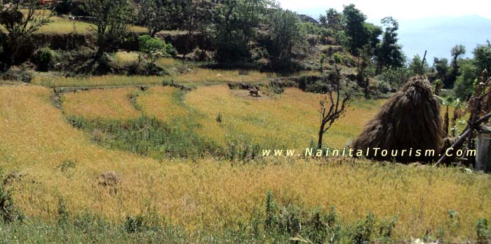
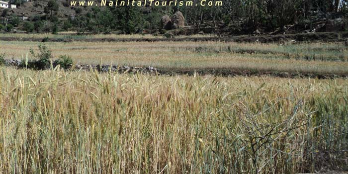
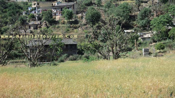
Gangolihat historical town in the lap of the majestic Himalayas.
A holy city, well regarded temples and verdant landscaper. A toure in
Gangolihat provides one with the unforgettable charisma of impeccable
sceneries that would stay with one for a long. It is quite sure that the
gushing streams deep ravines,lustrous valleys and most of all the lofty
contoured mountain ranges of this hilly resort would unwittingly hold
ones breath. Gangolihat looks amazingly vibrant and throbbing.
Gangolihat which is known for its rich culture of folk and ancient
myths. Gangolihat, has Mahakali temple Haat
Kalika Mandir where Shankaracharya established the Shakti
Peeth.. This place is dedicated to lord Shiva. During, the Navaratri festival,
a fair is held where pujas and sacrifices are offered.
Geography of Gangolihat
Gangolihat is located at 29.48� N 80.05� E. It has an average elevation
of 1,760 metres (5,773 feet). It is 75 km from Pithoragarh. Gangolihat
is native of Pant Brahmins.
Climate - Weather Gangolihat
Gangolihat town, being in the valley, is relatively warm during summer
and cool during winters. During the coldest months of December - January,
the tropical and temperate mountain ridges and high locations receive
snowfall and has an average monthly temperature ranging between 5.5
�C and 8 �C. Gangolihat district have extreme variation in
temperature due to much altitude gradient. The temperature starts rising
from mid March until mid June. The areas situated above 3,500 m remain
in a permanent snow cover. Regions lying between 3,000 to 3,500 m become
snow bound for four to six months. There are extreme points present at
the different places like the river gorges at Dharchula, Jhulaghat, Ghat
and Sera, where sometimes temperatures rise up to 40 �C. The annual average
rainfall is 36.7 cm. After June the district receives Monsoon showers.
Winter set for transhumance - seasonal migration among the Bhotiya tribe
with their herds of livestocks to lower warmer areas.
Seasons of Gangolihat
Winter or Cold weather (December - March)
Summer or hot weather (March - June)
Season of general rains (North - West monsoon-Mid June to mid September)
Season of retreating monsoon (September to November)
Tourist places Gangolihat | Places of Interest near Gangolihat
| Places Around Gangolihat | Gangolihat Sightseeing | Visiting Places
In Gangolihat | Gangolihat Tourist Places |
Gangolihaat is famous for its ancient temples and underground caves. 'Haat
Kalika', 'Ambika Dewaal', 'Chamunda Mandir', 'Vaishnavi Mandir' are some
of the famous temples here. 'Vaishnavi Mandir' is a special one because
from here one can clearly view the Himalayas. This temple is situated
on a mountain that is called 'Shail Parvat', which is notable in Hindu
holy books.
There are many beautiful underground caves in Gangolihaat. 'Patal Bhuvneshwar',
'Shailashwer Gufa' and 'Mukteshwar Gufa' are most notable ones. A new
underground cave has been also found recently and that is called 'Bholeshwar
Gufa'.
'Haat Kalika Mandir' was chosen by Sankaracharya for installation of Mahakali
Shaktipeeth. It is believed that the Original Goddes Kalika Mata, which
supposed to be in West Bangal, shifted her place form Bangal to Gangolihat.
This Temple is very famous all over the India, specially among Indian
Army Forces. Posthumous Param Veer Chakra award winner Capt. Bikram Batra
was a great devotee of Goddess and had created an Army Rest House near
the Temple for Army Personnel, who come Gangoihat to get the blessing
of Goddess, when they are at borders and fighting against the enemy .
Patal Bhuvaneshwar
It is a place 14 km from Gangolihat, famous for an ancient Temple
of Goddess Kali-Mother Deity of Indian Army's Kumaon Regiment. Hatkalika
Temple was established by Sankaracharya as a Mahakali Shakti Peeth at
Gangolihat. At a distance of 8 km from Gangolihat, there is a village
located in Tehsil Didihat, named Bhuvneshwar, where beautiful underground
cave of Patal Bhuvaneshwar, the subterranean shrine of Lord Shiva is situated
with sprawling interiors exist. Limestone rock formations have created
various spectacular stalactite and stalagmite figures. This cave has narrow
tunnel like opening which leads to a number of caves. The cave is fully
electrically illuminated.
Chaukori
Probably the perfect tourist destination to have full panaromic view of
snow capped Himalayan peaks in Gangolihat. It is situated 42 km
from Gangolihat and has an altitude of 2010 m. This place is also
famous for tea gardens and orchards. 
Munsiyari
Munsiyari is situated in the northern part of the Gangolihat district,
distance is 124 km. This small town is located at the foot of the main
Himalayan peaks, which are covered with snow throughout the year. Munsiyari
is in base for the track routes to Milam Glacier, Ralam Glacier, and Namik
Glacier, at the base of majestic Himalayan peak Trishuli (7,074 m). This
place is also famous for Munshiyari Bugyal, an alpine meadow. Alpine lakes
of Maheshwari Kund and Thamri Kund are around Munsiyari. The valley from
Munsiyari to Milam is known as Johar Valley. 
Askot Musk Deer Sanctuary
Askot Musk Deer Sanctuary is a 599.93 km� wild life sanctuary located
around Askot near Didihat, in Pithoagarh district of the Himalaya of Kumaon
in Uttarakhand, India.
Dharchula
Dharchula is a nagar panchayat in Gangolihat district in the state of
Uttarakhand, India. Dharchula is a beautiful valley surrounded by mountains.
An ancient trading town for the trans-Himalayan trade routes, it is covered
by high mountains and is situated on the banks of the river Kali. Dharchula
is about 90 km far away from Gangolihat and it lies on the route to the
Kailash-Mansarovar pilgrimage tour. The town is virtually split between
India and Nepal near the border with Tibet. The Indian side of the town
is known as Dharchula whereas its Nepalese counterpart is known as Darchula.
Didihat
Didihat, 54 km from Gangolihat, is a beautiful place with lush natural
beauty. Clear view of Himalaya is observed from this place, especially
Panchchuli range. Famous for ancient Shira-kot Temple of Lord Malay Nath,
built by Reka Kings. Nearby, ten km away from here Narayan Swamy Ashram
at Narayan Nager is situated.
Jauljibi
This is a significant trading centre bordering Nepal and 68 km from Gangolihat.
Situated at the confluence of rivers Gori and Kali, it turns into a lively
fairground annually. In the fair Bhotiya tribes use to sell their woolen
articles. A hanging rope bridge across Kali links this place to Nepal.
From Jauljibi tribal country of the district actually begins.
Madkot
Madkot, 22 km from Munsiyari, has hot water springs which are supposed
to cure rheumatism, arthritis and skin ailments.
Adi-Kailash (Chhota Kailash)
At an altitude of 6,191 M on Indo Tibet border in High Himalayas in Bhotiya
country, Adi-Kailash (Chhota Kailash) or Baba Kailash is situated. Trekking
from Tawaghat to Jollingkong one can reach here. On the way at Navidhang
sacred Hindu peak named Om Parvat, elevation 6,191 M, is visible.
Kailash Mansarover Yatra
The famous Hindu pilgrimage tour to Kailash-Mansarover passes through
the district. From Mangti pilgrims have to move on foot.
Jhulaghat
This small town on the banks of river Kali at Indo-Nepal border is named
after a hanging rope bridge across the Kali river. Previously it was called
'Juaghat'. Cross-border trade with Nepal takes place through this bridge.
Chhipla Kedar
Chipla Kedar is 34 km from Tawaghat situated 4626 meters (15,177
ft) above sea level. Very scenic and beautiful. An excellent place for
trekkers.
Berinag
A small town Berinag is famous for its natural beauty and sprawling tea
gardens at an altitude of 2010 m. Berinag is place from where Himalayan
snow-clad peaks can be viewed. The area has a number of Nag (snake) temples
of Dhaurinag, Feninag, Kalinag, Bashukinag, Pinglenag, and Harinag. Other
tourist spots are Tripura Devi Temple, Cave Temple of Koteshwar, Garaun
waterfalls, and Musk Deer Farm at Kotmanya. The Berinag is named after
the Nagveni King Benimadhava.
Jhaltola
A small village between Chaukori and Patal Bhuvanshwar, it was an erstwhile
tea estate and is at an altitude of 2100 meters to 2600 meters asl. There
is an old Shive temple at the top of the mountain known as Lamkeshwar
mahadev, it is an upcoming offbeat destination for tourists interested
in nature, himalayan views and birding. The village is surrounded on three
sides by fabulous mixed forests and has the widest range of Himalayan
views in Kumaon and a vibrant flora and fauna.
Distance between Gangolihat
Gangolihat is 60 km distance from its District Main City Pithoragarh
. And 227 km distance from its State Main City Dehradun.
Near By towns are Gangolihat (0 k.m.), Patal Bhuvaneshwar 10 kms,
Berinag (43.7 k.m.), Pithoragarh (60.4 k.m.), Didihat (35.8 k.m.) Chaukori
(30 kms)
Gangolihat Pin Code is 262522
How To Reach Gangolihat
The nearest major railway station to Gangolihat is Kathgodam (KGM) which
is at a distance of 181 kilometres. The nearest airport is at New
Delhi which is at a distance of 312 kilometres.
Air: Nearest airport is Naini Saini (Pithoragarh)
Rail:Nearest railhead is Tanakpur
Road: Gangolihat is well connected with the region by regular bus service.
By Road
Tanakpur-Gangolihat and Haldwani-Gangolihat mettled roads with buses,
jeep and other light vehicles regularly in service everyday.
By Railway
Nearest railway terminals are : Tanakpur in Champawat district connected
with Gangolihat by 151 Km long motor route via Champawat and Lohaghat.
Kathgodam
in Nainital district connected with Gangolihat by 212 Kilometers
long motor route via Bhowali, Almora, Daniya and Rameshwar.
By Air
The closest airport is Naini Saini at Pithoragarh, but is yet not operational.
Another option is to take flight from Delhi to Pantnagar & further drive
to Patal Bhuvaneshwar (Kingfisher Airlines operates during season time).
Pant Nagar
in Udham Singh Nagar district.
|
|
|