|
|
||
|
|
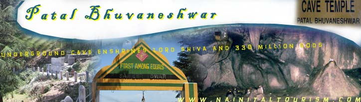
Patal Bhuvaneshwar It is a place 77 km from Pithoragarh at Gangolihat, famous for an ancient Temple of Goddess Kali-Mother Deity of Indian Army's Kumaon Regiment. Hatkalika Temple was established by Sankaracharya as a Mahakali Shakti Peeth at Gangolihat. At a distance of 14 km from Gangolihat, there is a village located in Tehsil Didihat, named Bhuvneshwar, where beautiful underground cave of Patal Bhuvaneshwar, the subterranean shrine of Lord Shiva is situated with sprawling interiors exist. Limestone rock formations have created various spectacular stalactite and stalagmite figures. This cave has narrow tunnel like opening which leads to a number of caves. The cave is fully electrically illuminated.
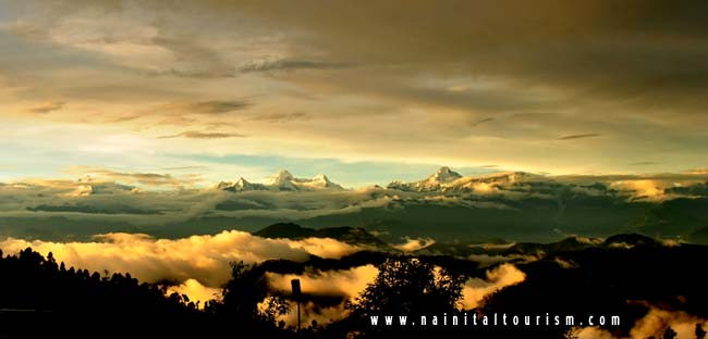
Chaukori Probably the perfect tourist destination to have full panaromic view of snow capped Himalayan peaks in Pithoragarh. It is situated 10 km from Berinag and has an altitude of 2010 m. This place is also famous for tea gardens and orchards.
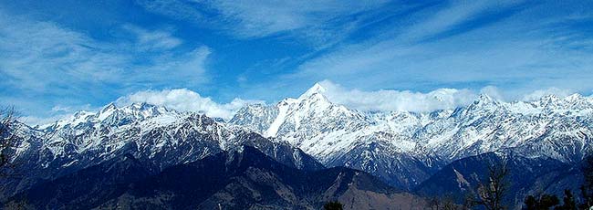
Munsiyari Munsiyari is situated in the northern part of the Pithoragarh district, distance is 124 km. This small town is located at the foot of the main Himalayan peaks, which are covered with snow throughout the year. Munsiyari is in base for the track routes to Milam Glacier, Ralam Glacier, and Namik Glacier, at the base of majestic Himalayan peak Trishuli (7,074 m). This place is also famous for Munshiyari Bugyal, an alpine meadow. Alpine lakes of Maheshwari Kund and Thamri Kund are around Munsiyari. The valley from Munsiyari to Milam is known as Johar Valley.
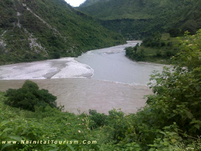
Askot Musk Deer Sanctuary Askot Musk Deer Sanctuary is a 599.93 km� wild life sanctuary located around Askot near Didihat, in Pithoagarh district of the Himalaya of Kumaon in Uttarakhand, India. Dharchula Dharchula is a nagar panchayat in Pithoragarh district in the state of Uttarakhand, India. Dharchula is a beautiful valley surrounded by mountains. An ancient trading town for the trans-Himalayan trade routes, it is covered by high mountains and is situated on the banks of the river Kali. Dharchula is about 90 km far away from Pithoragarh and it lies on the route to the Kailash-Mansarovar pilgrimage tour. The town is virtually split between India and Nepal near the border with Tibet. The Indian side of the town is known as Dharchula whereas its Nepalese counterpart is known as Darchula.
Didihat Didihat, 54 km from Pithoragarh, is a beautiful place with lush natural beauty. Clear view of Himalaya is observed from this place, especially Panchchuli range. Famous for ancient Shira-kot Temple of Lord Malay Nath, built by Reka Kings. Nearby, ten km away from here Narayan Swamy Ashram at Narayan Nager is situated. Dhwaj 15 kms from Pithoragarh near Totanaula, there is a mountain called Dhwaj, elevation 2134 m. It is an abode of Goddess Jayanti or Durga and Lord Shiva, atop the hill. Hindu legends tells that at this place 'Chanda and Munda' demons were killed by Devi. Dense forest about the mountain is considered sacred and sacrosanct, so it is in an excellent state of conserved biome with a large number of endemic plants. Jauljibi This is a significant trading centre bordering Nepal and 68 km from Pithoragarh. Situated at the confluence of rivers Gori and Kali, it turns into a lively fairground annually. In the fair Bhotiya tribes use to sell their woolen articles. A hanging rope bridge across Kali links this place to Nepal. From Jauljibi tribal country of the district actually begins. Rai Gufa This cave provides an excellent example of queer limestone deposits and situated near Pithoragarh. Madkot Madkot, 22 km from Munsiyari, has hot water springs which are supposed to cure rheumatism, arthritis and skin ailments. Adi-Kailash (Chhota Kailash) At an altitude of 6,191 M on Indo Tibet border in High Himalayas in Bhotiya country, Adi-Kailash (Chhota Kailash) or Baba Kailash is situated. Trekking from Tawaghat to Jollingkong one can reach here. On the way at Navidhang sacred Hindu peak named Om Parvat, elevation 6,191 M, is visible. Narayan Ashram A beautiful Ashram established by Narayan Swamy at Sausa near Pangu in 1936, on a way to Lipu Lekh, is full of wild flowers and rare varieties of fruits and number of waterfalls. The Ashram was primarily made to help Kailash-Mansarovar pilgrims. The ashram have been engaged in socio-spiritual works. Kailash Mansarover Yatra The famous Hindu pilgrimage tour to Kailash-Mansarover passes through the district. From Mangti pilgrims have to move on foot. Pithoragarh Fort It is set atop a hill on the outskirts of the town. The fort was built by the Gorkhas in 1789. The fort is currently used as a girls school. Kapileshwar Mahadev The cave temple dedicated to Lord Shiva affords fine view of the Soar valley and lofty Himalayan peaks. This temple is three kilometres from Pithoragarh.
Thal Kedar This ancient Shiva Temple is also known for its scenic splendour. During the annual fair of Maha Shivratri large number of devotees and pilgrims flock here. Situated at 16 km from Pithoragarh. Nakuleshwar It is believed that Nakuleshwara Temple was built by Nakula and Sahadeva (Pandavas). The place is located near Pithoragarh town. Jhulaghat This small town on the banks of river Kali at Indo-Nepal border is named after a hanging rope bridge across the Kali river. Previously it was called 'Juaghat'. Cross-border trade with Nepal takes place through this bridge. Chandak A beautiful place, 7 km from Pithoragarh, at an altitude of 6,000 feet (1,830 m), one can see panoramic and breath-taking view of the Pithoragarh Soar or Swar valley, from here. According to legends it is a place where demon 'Chandghat' was killed by Goddess Durga. Chhipla Kedar Chipla Kedar is 34 km from Tawaghat situated 4626 meters (15,177 ft) above sea level. Very scenic and beautiful. An excellent place for trekkers. Berinag A small town located 102 km from Pithoragarh, Berinag is famous for its natural beauty and sprawling tea gardens at an altitude of 2010 m. Berinag is place from where Himalayan snow-clad peaks can be viewed. The area has a number of Nag (snake) temples of Dhaurinag, Feninag, Kalinag, Bashukinag, Pinglenag, and Harinag. Other tourist spots are Tripura Devi Temple, Cave Temple of Koteshwar, Garaun waterfalls, and Musk Deer Farm at Kotmanya. The Berinag is named after the Nagveni King Benimadhava. Jhaltola A small village between Chaukori and Patal Bhuvanshwar, it was an erstwhile tea estate and is at an altitude of 2100 meters to 2600 meters asl. There is an old Shive temple at the top of the mountain known as Lamkeshwar mahadev, it is an upcoming offbeat destination for tourists interested in nature, himalayan views and birding. The village is surrounded on three sides by fabulous mixed forests and has the widest range of Himalayan views in Kumaon and a vibrant flora and fauna. Belkot Belkot is a small village in Pithoragarh District, around 10 km from Berinag. Located on the foothills of the Kumaon Himalayas, it is known for its salubrious climate and is home to the famed Bhagwati Temple. Thal Surrounded by Kalinag, Sundarinag and Dhaulinag, Thal is situated on the bank of the Ramganga river. Thal Valley has its own history main attractions are ancient temple of Lard Shiva and Ek Hathia Devalaya (temple carved by one stone and by one person in a single night). Gaucher is a nice place which is 2 miles (3.2 km) away from Thal market in route of Munsiyari and Kailash Manas Sarovar. Hajeti is the perfect place to capture the beauty of Thal valley on foothills of mighty Himalayas. Skiing ranges in Pithoragarh Khalia Top High altitude meadow with gentle slope, located 7 km from Munsiyari. Betuli Dhar It is one of the best ski range of Pithoragarh. It is a high altitude alpine meadow with ideal slopes and is situated at a distance of 5 km from Munsiyari. Chhiplakot Situated at an altitude of 3090 m near Baram on Jauljibi-Munsiyari road. This place provides an ideal skiing settings. Lakes in Pithoragarh Parvati Sarovar; Anchari Tal; Jolingkong Lake; Chhiplakot Lake; Maheshwari Kund; Thamri Kund How To Reach Pithoragarh By Road Tanakpur-Pithoragarh and Haldwani-Pithoragarh mettled roads with buses, jeep and other light vehicles regularly in service everyday. By Railway Nearest railway terminals are : Tanakpur in Champawat district connected with Pithoragarh by 151 Km long motor route via Champawat and Lohaghat. Kathgodam in Nainital district connected with Pithoragarh by 212 Kilometers long motor route via Bhowali, Almora, Daniya and Rameshwar. By Air Local airport situated at Naini Saini Airport Pithoragarh some 5 Km away from Pithoragarh town. Nearest commencing airport is Pant Nagar in Udham Singh Nagar district.
|
|||||||||
|
||||||||||||
| Nainital Tourism offers Accommodation - Transport - Pick Up & Drop from Pithoragarh Airport to anywhere in Pithoragarh District |
| <------- - Our Own Other Uttarakhand Tourism Websites ---------> |